Coronado Trail Scenic Byway
|
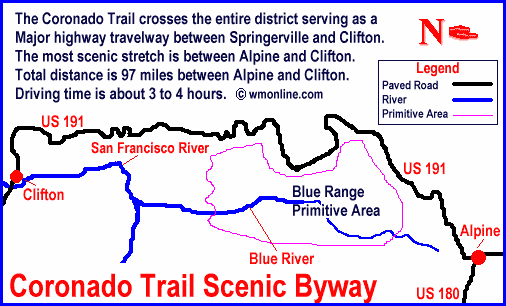
Apache-Sitgreaves National Forest White Mountains Online wishes to express our appreciation to the USDA Forest Service, Alpine Ranger District for providing this information!For more information, please feel free to contact the USDA Forest Service, Alpine Ranger District at 520.339.4384 or you may write us at P.O. Box 469 Alpine, Arizona 85920Route: The Coronado Trail crosses the entire district serving as a major highway travelway between Springerville and Clifton. The most scenic stretch is between Alpine and Clifton. Total distance is 97* miles between Alpine and Clifton. Driving time is about 3 to 4 hours. * Mileage is only one way. Total mileage will be approximately 194 miles. Drive time includes round trip distance.
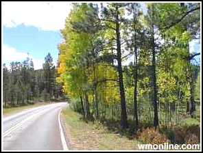
Notes: The Entire route is paved. Snow is not plowed from the road on weekends or at night in the winter. Be sure and gas up in Alpine. There are no service stations along this stretch of road. Best season: This is a good drive at any season of the year. It’s the only up-land road on the district kept open during the winter when it’s plowed between the hours of 8:00 am and 5:00 pm—weekdays only! Attractions: This road traverses the Alpine District along a high ridge where elevations range over 9,000 feet. While you're in the Hannagan area, stop and see the plaque embedded in a roadside boulder at the dedication of the road at its completion in 1926. It’s about a hundred yards south of the Hannagan Lodge. |
 |
|
contact the Alpine Ranger District : P.O. Box 469 Alpine, AZ 85920 (520) 339-4384 To go back the Alpine Ranger District Scenic Driving page Click Here Greer & Springerville
Trails Cites and Towns of the Arizona White Mountains |
